BSES Amazon - Peru - July 2012 - Trip Report

Photos from Aston Nicholls

In summer 2012 I was lucky to be invited along to the Pacaya Samiria reserve in the Peruvian Amazon as a Canoe Leader & Jungle Guide on the British Exploring Society’s expedition.

Sadly my camera broke just before the trip so I’ve only got a couple on file!

551042_4398150160975_689414563_n.jpg

I headed out ahead of the main expedition as part of a small advance party. It was our responsibility to get everything set up for the 50 or so young explorers 20 odd leaders that were coming out to the jungle for approximately 5 weeks. This was a very busy period; buying and packing food, testing and fixing equipment, developing jungle and canoe training sessions for the young explorers; recceing the area and running mock rescue and evacuation scenarios.

For the young explorers the expedition was split into 2 phases; a three week adventure phase (with 1 week canoeing, 1 week trekking and 1 week at a science camp) and a community phase. Some of the young explorers and leaders, myself included, were only there for the adventure phase due to other commitments.

Eventually everything was ready and the young explorers and rest of the leaders turned up on a boat to the small village we were staying here. The boat had been delayed slightly and it was dark by the time it arrived; as a (really long!) human chain was formed to pass the considerable amount of equipment from the boat to the village you could see a strange mix of tiredness, excitement and uncertainty on the face of every young explorer there.

The morning quickly came and we split off into our respective groups (or fires as they were called) to start the expedition. Each fire consisted of a couple of leaders and about 8 young explorers. My fire were transported by peki-peki (a small motorised dug-out canoe) to a clearing where we began jungle training and started our expedition. Over the course of the day the young explorers were trained in a wide range of important jungle skills such as using machetes, erecting tarps and hammocks, safe water collection, jungle hazards, comms and camp hygiene. It was an intense day but everyone worked hard knowing that they would need to be using their new knowledge lots in the coming weeks!

The 3 weeks passed quickly for me, canoeing during the day and socialising with the young explorers and other leaders during the afternoon and evening. Each week the young explorers rotated to different leaders (to do a different activity within the adventure phase) so I had the pleasure of meeting and working with a large number of fine young men and women.

Highlights for me had to include:

-        Seeing huge numbers of pink river dolphins who would come almost up to the boats

-        Going caiman spotting at night in the canoes

-        Having jam and bread fresh from the fire for breakfast occasionally

-        Seeing one of my fellow leaders perform an amazing dance after being bit by a bullet ant!

The jungle was amazing, vibrant and alive but very dangerous as well. As I headed back to Iquitos for my flight home it was astonishing to see the difference once I left the reserve (on the way in I’d been sleeping so hadn’t realised!). Instead of the bustling, busy, beautiful jungle I was used to there was just miles and miles of deforested waste land. I’m not normally much of an ‘eco-warrior’, I like nature and wild places and I’m personally careful and respectful when in them, but I’ve never been particularly active in trying to protect them. However, seeing this wasteland truly saddened me, it is just another, particularly striking, example of the damage humanity is doing to this world.

I hope to go back to the jungle one day, I would like to explorer more of it and I’m sure there’s lots of remote areas, rivers and caves that haven’t been looked into in detail. It was great to see how the young explorers developed over the course of the expedition, both in terms of their jungle skills and their personal characters. I’d thoroughly recommend the Bristol Exploring Society’s expeditions – it was also a great experience for me, with lots of new experience gained, and I certainly hope to be active with them again in the future.

Snowy Corsica - April 2014 - Trip Report

I’d flown out with only hand luggage as a friend was driving most of my kit down for a kayaking trip. As I had a couple of days spare I decided to head out for some exploring.

I was in the Mediterranean, it was sunny and warm, and I was looking forward to a relaxed jaunt in the mountains. Then suddenly the road was blocked by a large snow mound.

Not to be put off I packed my bag and started walking. I soon passed the snow and concluded that my equipment (trainers, a thin sleeping bag and no roll matt being some of the problems) would probably be fine after all.

However soon the unmade road turned to a snow covered mountain path. I pushed on, my trainers sinking in the soft snow, until I reached a small mountain lake a few hundred metres below the summit I’d been aiming for.

I ‘made’ camp here, curling up in between and on some large boulders so that I could get out the snow. The night was cold; I woke up regularly and would nibble some food to temporarily warm me and lull me back to sleep before the cold chill once again woke me shivering in my sleeping bag.

I abandoned the climb early in the morning. I’d eaten most of my food, my phone wasn’t working and no-one knew where I was. Tail between my legs I beat a hasty retreat back down to beneath the snowline and the Mediterannean’s warming sun.

Caledonian Canal, Scotland - July 2016 - Trip Report

The best photos are courtesy of Beth Logan

I’d just resigned from work with the intention of taking a year out to focus on expeditions. The only problem was that I’d made this decision quite suddenly, and as such actually had no trips in the pipeline!

Fortunately I’d met Beth Logan a few weeks previously at a Cave Leader revalidation course. She lived close to me and we’d stayed in touch. I knew that she had some time off from her job as an outdoor education instructor and suggested the Caledonian canal as an easy-to-organise mini-trip. She was keen and so plans were set in motion – within a few days of first talking about the trip we were on a long drive to Scotland!

After the drive I left Beth ‘wild camping’ (aka hiding in the bushes) near the start of the canal in Fort William whilst I left to run the shuttle. I only got a few hours sleep that night and managed to miss the first bus back to Fort William and so ended up being a couple of hours late. Beth had started to get a bit worried (I’d left all my phone charging equipment with her and my battery had run out) but had done a sterling job of lugging all the kit from her hiding place and up past all the lochs to the start.

The next few days were great; after a very hard working year (I was regularly working 60hrs+ a week) it felt great to be unencumbered and free in the river. This was my first real long distance canoeing trip and Beth was a great partner, we sped along the canals and tried our hand at sailing across the lochs using a survival shelter.

We choose a slightly suspect wild camp the first night on a small slightly boggy patch of land. It was away from other people but not from insect…my dinner that night probably consisted of more bug than pasta! My big year of adventuring did not seem to have got off to the best start – I decided to sleep outside that night but then spent an hour that morning cowering in my sleeping bag trying to avoid the bugs and waiting for Beth to wake up!

On the second day we came across a ‘pub canal boat’ on the river and stopped for a drink. It was pleasant but eccentric place – various swords (including a ‘real’ lightsaber) and other paraphernalia were on display. The owner was also apparently only one of six chefs in the UK licensed to use this particularly strong chilli. As a result there was naturally a ‘chilli challenge’ that he offered – anyone that could finish his curry (containing 4 tea spoons of the chilli) ate for free. I was not up for any type of chilli challenge but four guys wanted to try the mini challenge; a pin prick of the chilli mixed in a tea spoon of chutney and served on a small cracker. It didn’t go well for any of them – within seconds they were sweating and struggling and by the time a minute had passed all had disappeared to the toilets.

Beth and I carried on for another couple of beautiful hours. We’d had a couple (4…) of beers and were merry and happy. The canal was empty and the waters still, paddling through a forested area we could see the perfect crystal clear reflection of tall pines in the water. I felt surprisingly at peace; I’d never felt stressed in my job, just focussed, but it wasn’t until this point that I consciously acknowledged just how less stressed I felt now. It was a strange revelation for me to realise that I had been stressed before – it’s kicked off a long (and still unfinished!) train of thoughts as to where I’m going and what I want from my life.

After crossing the watershed we decide to take the rivers downhill to the coast, rather than just following the canal. Embarrassingly we had a capsize when attempting, purely for fun, a tight white water break-out. Kit went everywhere and the fisherman downstream enjoyed laughing at us as they rowed out to fetch a couple of lost bags!

All too soon the adventure was over and we just had the long drive back to Bristol. A short but sweet adventure, and one that would be achievable for most people.

Corsica GR20 Trek - September 2016 - Trip Report

The GR20 was my first long distance trek (and I say this loosely as it’s more up and down than long distance, around 11,000m of ascent over 180km makes for some pretty steep terrain). I’d paddled and hiked in Corsica in April 2015 and immediately been taken by the beautiful rocky spires and ridgelines. I knew it was somewhere I’d need to come back to.

My attempts at mountaineering on that previous trip had failed. I’d flown out a day or two of the paddling trip (which was travelling down by road) and decided to give a mountain climb a go. Unfortunately I’d travelled out in mountain trainers and with only hand luggage. Being part of the Mediterranean I’d assumed Corsica would be warm and a two day mountain route would be easy. As such I hadn’t really researched the route, instead just buying a map and renting a car once in country. This turned out to be a mistake – my drive in on the planned route was blocked by snow and after a very cold bivvy I turned round the following morning without completing my ascent.

Thankfully our GR20 was much more successful. There is a lot of hype on the internet about the GR20 being “the toughest long distance trail in Europe”. Don’t let this put you off – the GR20 is definitely do-able for a prepared and fit group. The ‘Logistics’ section contains information that may help you decide if this trek is for you.

Our trip started slowly as we struggled to find gas canisters. We’d flown out on a Sunday (more due to the availability of cheap flights than anything else) and couldn’t find any canisters at the SPAR just off the T30 road past the Tankstelle VITO train station. The supermarket in Calenzana was shut by the time we arrived and so we sat down for a late lunch while we considered what to do. Almost immediately an intense rain and thunderstorm started (although luckily an awfully nice lady offered us shelter under her porch and then brought us out tea and coffee). I’d heard all about the mid-afternoon thunderstorms of the GR20 and resigned myself to the fact that this is what we were going to have to deal with whilst trekking – thankfully this was by far the worst weather we encountered over the two months!

The night didn’t go well either. Emily’s brand new ultra-expensive lightweight Lightwave tent just didn’t work. After struggling for about 30 minutes to put it up, and even resorting to the instructions, we gave up. Fortunately I’d had a decent repair kit with me and we were able to remove one of the sections from each of the geodesic poles – the tent now went up but sat on a bit of a camber and just looked odd! Emily had managed to get this tent up once in the UK but she reported it was very difficult – I’m 95% certain we weren’t doing anything wrong and that the tent materials had somehow contracted (from heat or humidity???) making it impossible to fit the poles in.

As we were waiting for the supermarket in Calenzana to open we were able to have a relaxed start. Stocked up on gas and fresh bread for our lunch that day we headed out from Calenzana. The trail slowly gains over 1300m of height of height on the first, the town and dry scrubland gradually falling away as majestic granite mountains grow in the distance.

Our first bivvy spot was actually one of my favourites. It was very obvious and approximately halfway along the 2nd section where the trail drops down into a gulley before quickly rising back up again. Some stone walls are guarded by a huge rock (for some reason this strongly remind me of ‘Pride Rock’ in Disney’s ‘The Lion King’!). The rock provides a flat surface for cooking and sun basking on, and even has some rudimentary benches set up! With a stream just a hundred metres away along the trail this was a pretty ideal spot! Clambering round the back of our rock to watch the setting sun I felt very content, I’d been back in the UK between my caving trip and this for 3 weeks and had grown restless. It felt good to be back out in nature again.

Note that you’re not allowed to wild camp on the GR20 so set-up late and practice ‘Leave No Trace’ ethics if you do – we were then in September and never encountered any problems wild camping, this might be different in the busier summer months if rangers are more active. I’m not sure how I feel about wild camping; I understand the authorities’ desire to protect their landscape but for me wild camping is an integral part of the experience. Plus I regularly (rightly or wrongly) wild camp in the UK so it would be hard to justify a decision not to abroad.

Not really believing the good weather we’d experienced yesterday we set out early the following morning to avoid the GR20’s renowned thunderstorms. We soon realised this to be a mistake as we struggled to find trail markings through a wooded section and made slow progress for the first hour or so until daylight broke. Within another day or two we’d realised that regular afternoon thunderstorms were unlikely and so we could probably afford to wait until day break before starting out.

Soon we were past the hut and into the third section, which was probably the most beautiful part of the trail. You soon cross a river using a bridge and then walk up a wooded valley with a beautiful river running on your left-hand side. Some parts of this section were equipped with chains as climbing aids; this was generally for steep slab sections rather than full on climbing/scrambling. Much is made of the scrambling difficult of the GR20 but to be honest I didn’t find it that bad. Harder scrambles were few and far between, short and well equipped with fixed aids. There were more slab moves (where you needed to walk up or down a steep smooth rock) than climbing moves and these would be more difficult when wet – that said, again these were generally well equipped with fixed chains.

The next few days passed in a bit of a blur. Steep ascents and descents, row after row of granite mountains and ridgelines and crystal clear rivers filled our days. On a misty afternoon on the 3rd day we crossed a large grassy area with a lake, the whole area criss-crossed by small streams and soil pits filled with dirty water from the local horses. Consulting the map I saw that this was the source of the Tavignanu, a river I had paddled on my previous trip to Corsica. Seeing the water quality at this source has made me dubious of all the times I’ve drank seemingly safe river water in the wild – you never know what’s upstream!

After 6 days we descended into Vizzavona, a small village which separates the north half of the trail from the south. Vizzavona is small but there are a couple of restaurants, two small resupply shops (one in the trail campsite and the other near the train station) and the train station. There are also some good ruined buildings for anyone into urban exploring!

We decided to take a rest day and head out to Corte on the train. Food resupplies had been limited and very expensive so we figured that by heading to Corte we would be able to get a wider range of cheaper food. We also decided to buy food for all our remaining days here (to save money) – this didn’t work out particularly well for me as I’d been carrying all the food (as Emily couldn’t fit it in her bag) and therefore I ended up with a heavy pack for the next couple of days!

The trail was noticeably easier after Vizzavona, particularly once I’d eaten some of the food and got my pack weight down. The terrain was less technical, and the ascents and descents were less steep.  Emily had jokingly complained how she could still see the sea for the first few days of the trail – we were meant to be walking away from it! The sea had soon disappeared but, on our 3rd day after Vizzavona, the sea re-emerged after we ascended a hill – the end was in sight!

By now the terrain had become less harsh, craggy mountains were replaced by rolling fields and clear mountain streams by babbling brooks. One of my favourite spots came on our penultimate day, walking along part of the trail that felt more like the English countryside than the Corsican mountains. The day had been relatively easy and we’d seen lots of wildlife, include wild boar, and so were both feeling very positive. We’d seen lots of idyllic camping spots but pressed on, eager to stick to our plan so we could have a couple of ‘tourist’ days at the end of the trail. The photo below doesn’t really do this spot justice but I found it to be very serene and beautiful, a gorgeous mix of yellows, greens and browns offset and accentuated by the sound of running water and the cream boulders lining the river bed.

We had bivvied just past the last refuge (Refuge d’I Paliri) so our final day was short. This bivvy was also a good one, set back up in mountain landscapes on a plateau with impressive views all around. Emily set off ahead of me on the final day and was suffering from a knee injury and had slowed down a bit on the descents, I just wanted to finish reading my book! I’m not sure if it was because it as the last day, or because I was hiking by myself, but I found the scenery along this descent to be wild and I felt isolated – it was wonderful. The trail alternated between dense forest, rocky landscapes and dry river beds and we saw more people on this section (presumably day hikers from Conca) than we had typically done on the trail. I caught up with Emily on a long traverse section and we walked the last hour or so into Conca together, it was a surprisingly long way from the end of the trail through the town to accommodation or onward transport, particularly when you really want a beer!

Iceland Coast-to-Coast - May 2017 - Trip Report

The best photos are courtesy of Neil Irwin

Trip reports from the trek team's expedition have been written by Ben James and Neil Irwin

Pjorsa Source to Sea

This packrafting source-to-sea descent of the Pjorsa was undertaken in June 2017. All notes are based upon the conditions experienced at the time. We understand we had average water levels for the season. It is our understanding that the river flow below the dams near Burfell is regulated to 300 cumecs all year round.

Along the length of the Pjorsa there are long stretches of flat water or easy rapids. However, with the exception of the lakes and the final part of the river after Uridafoss there is always a fast current to help speed the paddler along.

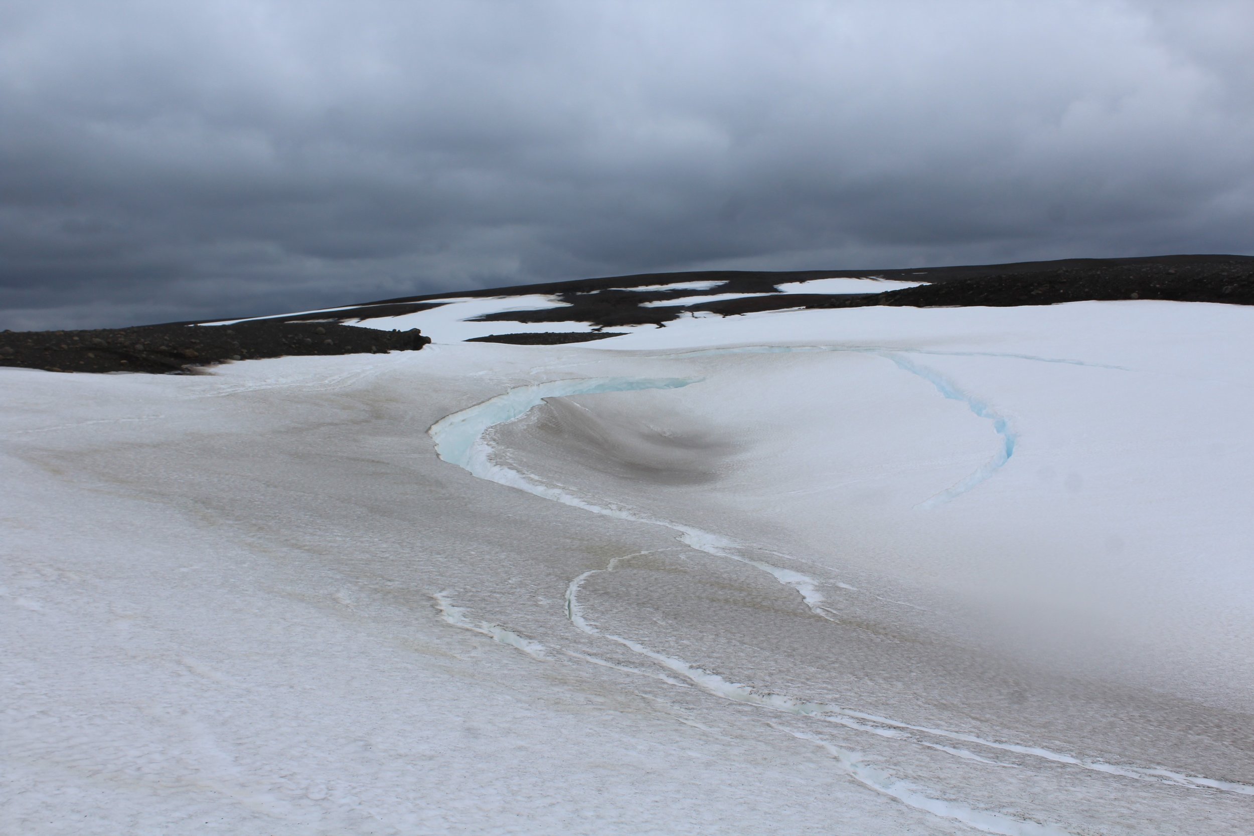
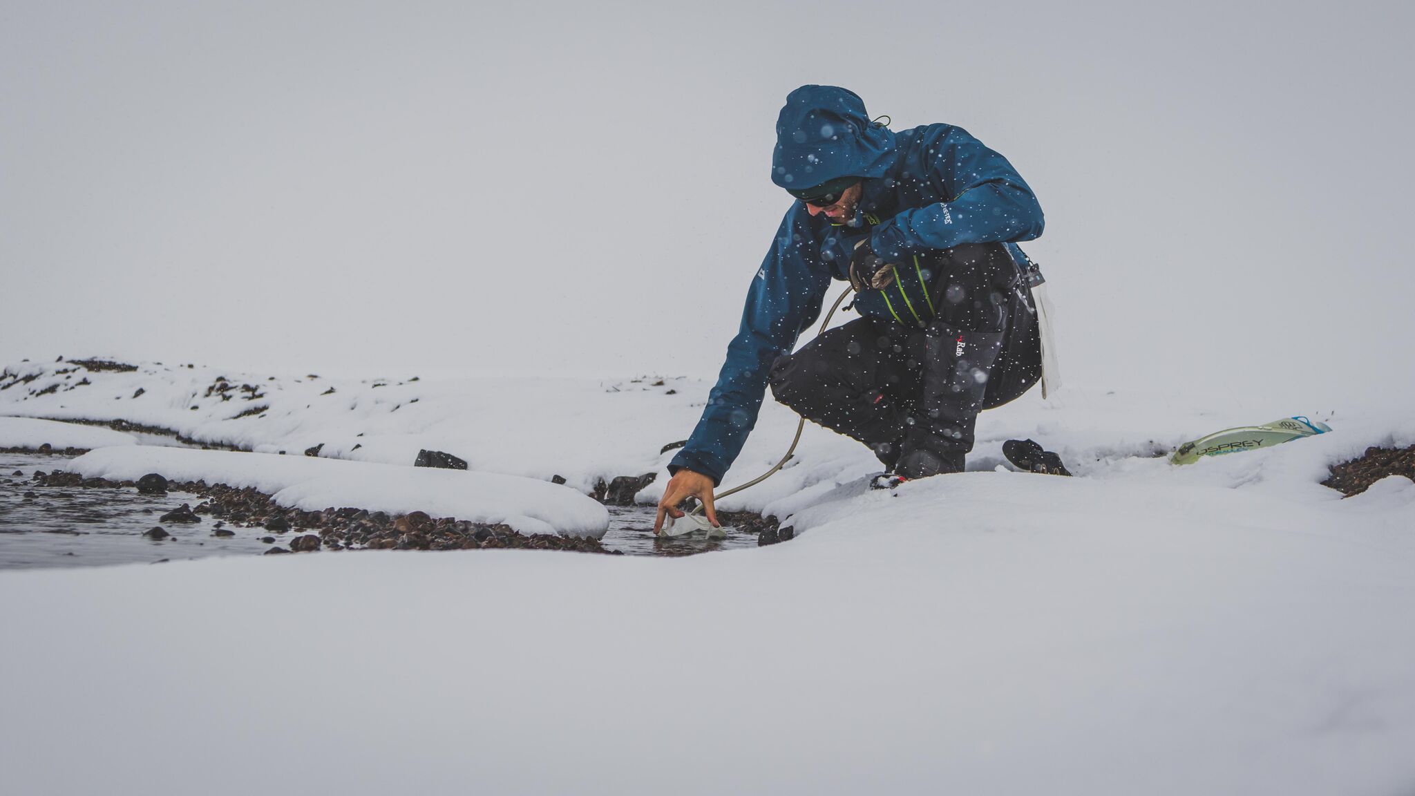
The source of the Pjorsa is a stream feeding a small lake at 64.984431° N, -18.023638° W. In June 2017 this stream was a snowfield but, in any case, is unlikely to be navigable at any time. For 15km from the lake outlet to the confluence with the river at 64.918000°N, -18.161281°W, the river is mostly unnavigable. Our team attempted to paddle part of it but regularly had to drag or carry boats around shallow areas – we would recommend ‘portaging’ this whole section unless water levels are much higher. A few kilometres from the lake outlet a spectacular mini-canyon cuts into the barren landscape with jagged rock formations and snow bridges waiting to great the adventurous paddler. The canyon contains four drops of various sizes (from around one metre to several metres). Unfortunately for three of these drops the entire river sumps underneath snow bridges, forcing (easy) portages. Due to the snow cover in June 2017 it was difficult to assess the feasibility and difficulty of the drops as only the exit pools could be easily inspect (sometimes only by paddling back upstream underneath the snow bridges!). This gorge could potentially make an interesting short paddle and deserves further investigation in warmer/wetter conditions.

For the 35km from the confluence to the lake the river is often flat with intermittent rapids up to grade 2/2+. One exception to this is a grade 4 rapid (64.893749°N, -18.217254°W) with a rocky landing approximately 4 km after the confluence. This rapid is much harder than anything else in this section and so its approach should be obvious. It is important to stop well above the entrance rapid as steep banks would make inspection or portage difficult lower down.

The southern end of the lake is dammed and there is no appreciable flow below it. This part of the river is also fenced off and so presumably access is prohibited, although it would be easy enough to follow on foot. An alternative is to paddle a man-made channel on the eastern side of the lake to a second smaller lake. From the southern end of this lake it is possible to trek 3 or 4km west, crossing the road near an emergency shelter, back to the main river. Accessing the river at the closest point (i.e. shortest trekking distance) is coincidentally just about where it becomes navigable again. To access the river here still requires that a fence is crossed, alternatively the fence line can be followed for at least several kilometres until it permits ‘natural’ access to the river.

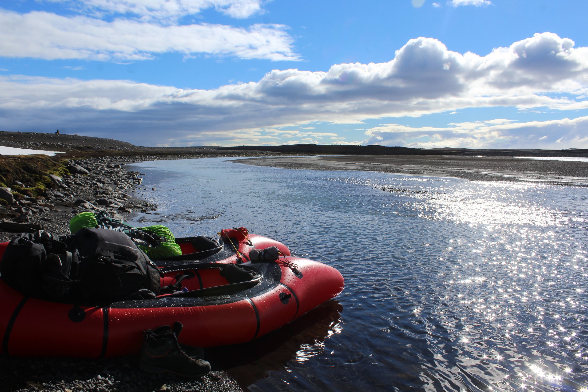
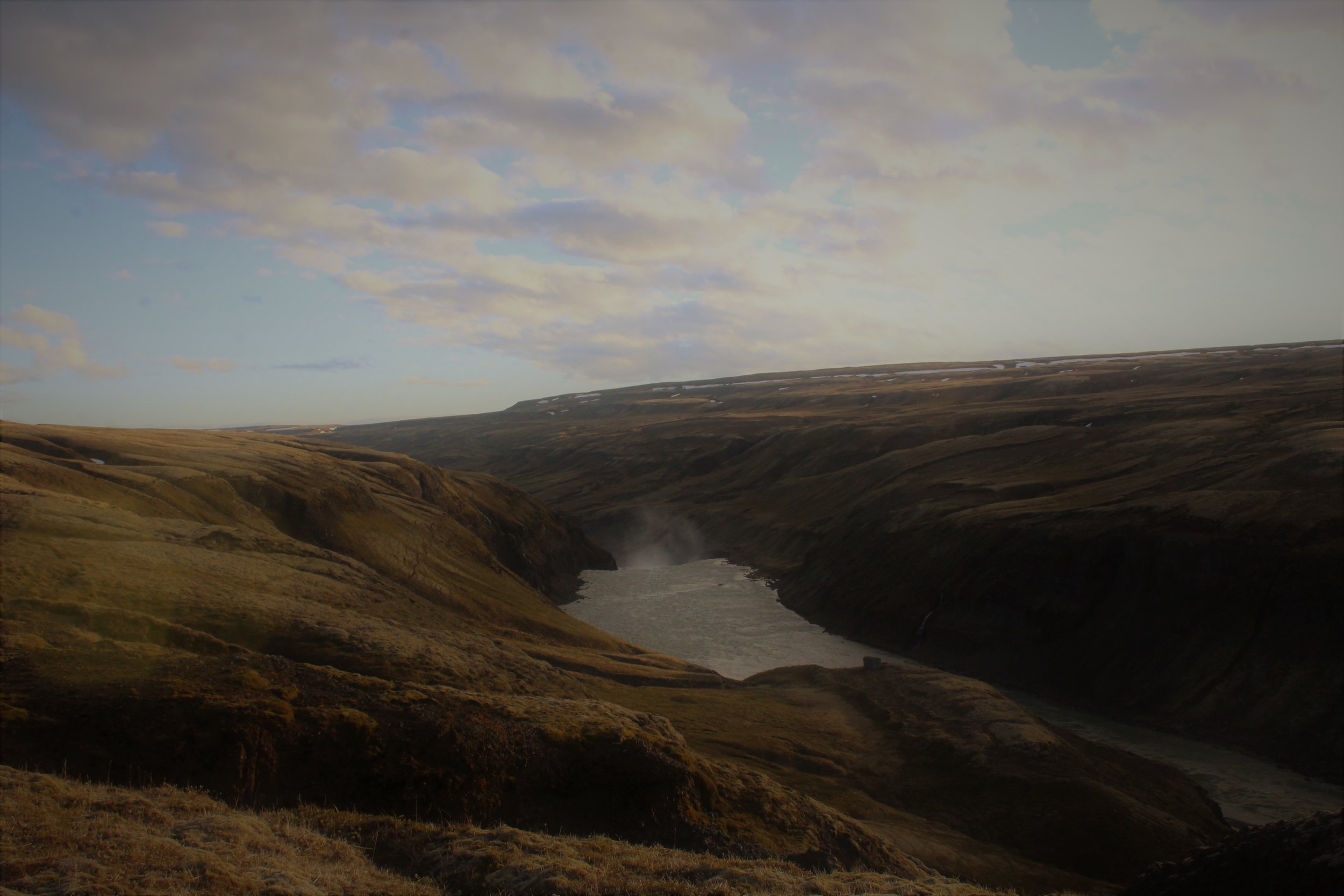
For the next 25km the river is flat and split across many channels. In many places the river is scrapey but with good planning (and a little luck!) dragging or portaging the boats can be avoided – a good rule of thumb seems to be to always take what appears to be the most voluminous channel! As you continue downstream the river gradually increases in volume as the many channels begin to merge together. As this happens the crystal-clear water of the upper river gradually turns a silty grey, a symptom of the glacial run-off.

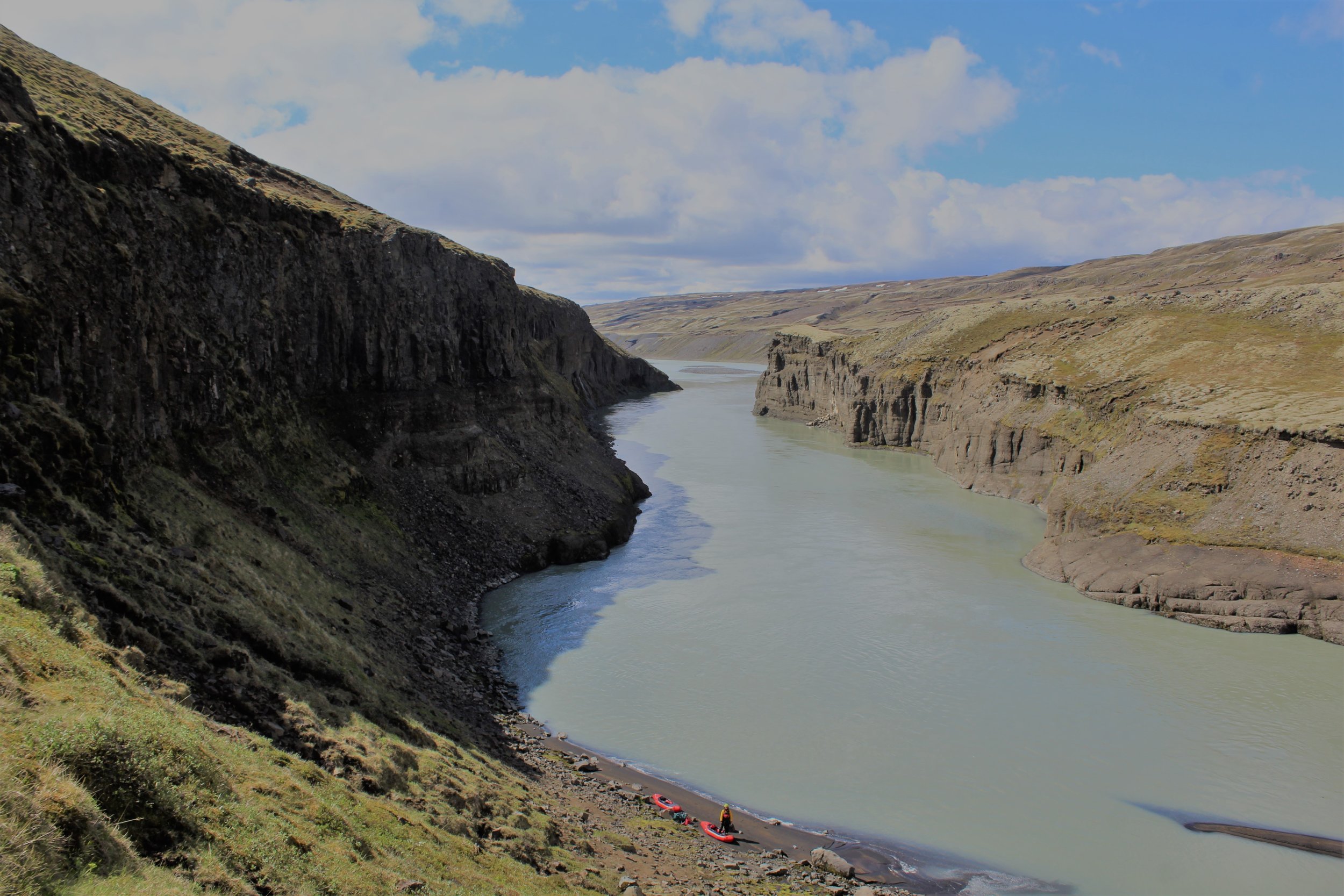
At 64.458889°N, -18.962275°W the river splits around an island. The river right channel goes at G3. Shortly afterwards at 64.416781°N, -19.053645°W a grade 4 rapid appears. In low water you can climb out on the rocky ‘bank’ (it’s actually part of the river and is likely to have a small amount of water running over it) to inspect. In these conditions the water all funnels river right dictating the line – in higher water more lines would open up but inspection would be harder.

At 64.391668°N, -19.099013°W is the first waterfall (4km from grade 4 rapid), can be run via various lines. Then another 4km to where river splits (64.359554°N, -19.154802°W) around an island with hard rapids (Grade 4-) on both sides. The 2 channels converge temporarily before almost immediately splitting again, stay river left and get out partway down this next channel – you’ll probably want to portage the next waterfall. After this waterfall there are some decent looking rapids in a deep canyon – access is difficult so it is probably easiest to portage approximately 5km past the next waterfall. After waterfall 3 rivers calms down to flat.

The next 7km to the lake are flat but very scenic. Be careful of sandbars near the start of the lake. Near the dam on its west bank you’ll see a small innocuous whirlpool on the surface – stay well clear (when you get back on the other side of the dam you’ll see what I mean!). On the other side of the dam pick a spot to put back on depending on your ability. The river gets progressively easier from the dam so don’t be put off by the dam’s discharge and the steep banks. After a couple of bends the river is flat again and stays like this all the way to the weir at 64.165460°N, -19.598425°W.

The weir itself has a strong towback and no weaknesses. It is probably best to portage on river left. 5km after the weir a waterfall is obvious on the horizon. There are various lines (some slides) split by small rock islands/towers, but generally speaking the left-hand side looks easier than the right. Land some way above the waterfall on the river left and scramble up ‘sand dunes’ to inspect.

Within 3km (G2-) you’ll arrive at the next waterfall. Again this waterfall can be run but is probably easier from the right hand-side (note the photo on Google Earth by robiswiss@falnet.ch is of Þjófafoss, not this one). Land river right to inspect as it would be difficult to ferry across from the left bank. The first few hundred metres after the waterfall consists of G4+ rapids in a mini gorge. After the obvious crux the rapids quickly get easier and there is nothing else of significance in this mini-gorge. This is not the grade 5/6 gorge mentioned here (which didn’t seem to exist, or as the river splits a bit around here, was a minor side channel we didn’t even see).

Soon after exiting the gorge you will arrive at a third waterfall, Þjófafoss, which will be a portage for almost all groups (supposedly severe criminals used to be thrown over this waterfall for their punishment!). Egress is reasonably simple but finding a way to get back to the river can be difficult due to steep cliffs. We landed on river left but from our perspective river right seemed like the better option.

From the bottom of Þjófafoss the river is at most G2- for 21km until 64.041172°N, -20.154574°W. Here the river splits around an island. We took the right-hand channel, scrambling high on the bank to inspect, which was a 750m G4- rapid. The rapid consists mainly of large wave trains hiding the odd hole. In particular be wary of a large hole covering a large chunk of the right-hand side of the river just before the two channels converge again – you will likely have been pushed right on the previous bend but try and get as far left as possible before the obvious final drop/wave/hole. Overall this rapid is much bigger than it looks when inspecting from the bank!

5km of easy water bring you to the next water, Budafoss (64.03110°N, -20.286935°W). We found this the hardest waterfall to spot from a distance so pay attention – essentially this is the first thing of any significance after the rapid detailed above. If you’re not sure get out and look! Land river left to inspect – the easiest line is probably hard left but portage is also easy.

From here the river remains easy until the obvious narrowing of the river a couple of kilometres above the ring road. This rapid is described here but is essentially a grade 4 wave train rapid through a gorge. The hardest part is right at the start (and can be avoided by paddling right around the rocks) and the river has eased by the time you cross under the old bridge.

From here it is best to stay right as this will allow you to paddle close to the top of the next waterfall with no significant difficulties (both the lead-in rapids and the actual waterfall are far harder on the left-hand side and would not be worth the risk in my opinion). This waterfall is Uridafoss and can run at grade 4 on right river via a series of slides and small drops. Portage is also easiest from the river right bank. There are likely to be tourists at this waterfall so be prepared for some observers!

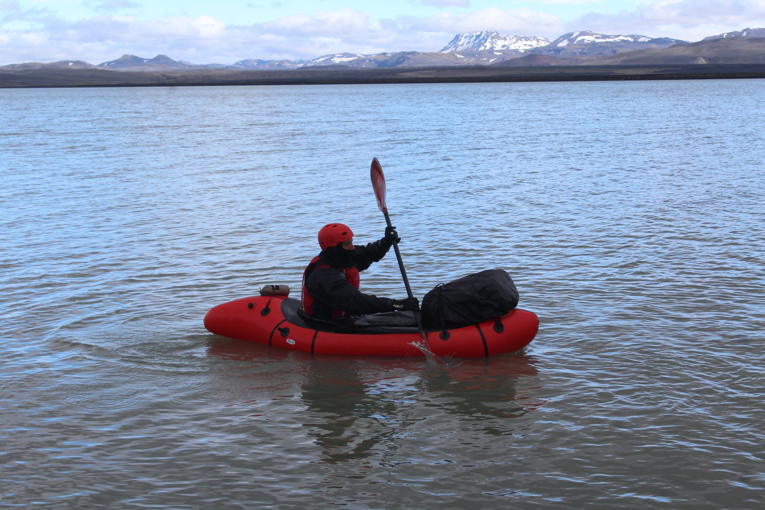
Being Iceland’s most voluminous waterfall, paddling out underneath Uridafoss is an awe-inspiring experience. From here it is around 20km or so down to the sea along mostly flat and slow-moving water. Winds also tend to blow in off the sea and slow your progress. The scenery for this part of the river is not Iceland’s most exciting, but the likelihood of seals following you down the river more than makes up for it.

Eventually, by a deserted and desolate blank sand beach, you have made the coast! The waves here and strong and powerful – two experienced Icelandic sea-kayakers drowned at the Pjorsa river mouth in 2017 so it is advised to land in the protected ‘bay’ just before the actual mouth and walk the last couple of hundred metres.

Iceland Coast-to-Coast - May 2017 - Trip Report

The best photos are courtesy of Neil Irwin

Trip reports from the trek team's expedition have been written by Ben James and Neil Irwin

Being whipped by horizontal snow at the source of the Þjórsá, Leanne and I looked at each other and wondered if we’d bitten off more than we could chew. We were deep in Iceland’s desolate interior and having just left our friends behind we were now all by ourselves, cut-off from help, and with around 230km to paddle before we reached the North Atlantic ocean.

I was nervous; all the other Icelandic packrafting expeditions we’d come across had either had their packrafting equipment delivered to the start of the river, or had mainly trekked and done little packrafting. We were completely unsupported – there would be no resupplies so we were carrying everything we needed to hike, packraft and survive in Iceland for over 2 weeks. We also were attempting to packraft Iceland’s longest river from its source to the sea – we knew there would be a few waterfalls we’d need to portage but we hoped to paddle nearly all of the river and rapids. Therefore we had to have ‘proper’ kayaking kit; there would be no inflatable life jackets and missing helmets like some expeditions, but also we couldn’t afford the weight penalties of carrying our normal kayaking gear.

We ended up settling on a number of lightweight items rented from the Packrafting Store. It was a mixed bag. All of the items were good for their weight but I wasn’t sure I trusted some of them for a pushy descent of an unknown huge volume river. We’d taken the packrafts to HPP (an artificial white water course in the UK) to test them out but the results hadn’t been reassuring – neither of us could really roll the boats in rapids and we’d both taken a couple of swims. There aren’t many people in the world taking packrafts down grade IV rivers, and fewer still doing that with lightweight minimalistic gear and a 15kg bag strapped to the front of the boat. Leanne has only been paddling for just over a year, and this was my first time on a river of this width and volume – I just hoped I knew what I was doing.

We believe this is the first recorded source-to-sea descent of the Þjórsá[1], with Leanne also being the first recorded woman to complete a packraft traverse of Iceland. Icelandic kayakers were also unable to provide any detailed information on the upper sections of the Þjórsá – we were in virgin territory and needed to be careful.

It had taken us four and a half days to walk to the Þjórsá’s source from the coast in Akuyeri. We were accompanied by three friends who were continuing on to complete an unsupported trekking traverse of Iceland. This trek team operated independently in terms of food and equipment but it was encouraging to have their company at the beginning of our trip.

Our packs were heavy (mine was nearly 35kg at the start), crushing our shoulders and rubbing mercilessly on our hips. We hadn’t been able to afford high quality split paddles so I had two 2m paddles strapped to the side of my bag. I couldn’t sit down or easily remove my pack so whilst the others rested I often had to adopt a ‘sprinter starting block’ position as this was the easy way to get the weight off my shoulders and legs.

We made good progress on the first day, covering 11km in just 2.5 hours after driving to Akureyri from Reykjavik. Despite the weight our spirits were high, the weather was good and even walking along a road this close to the city felt remote. I’d spent the previous month in England attending weddings, stag dos and wine tours. After 4 months in Nepal the UK had seemed loud and claustrophobic; I relished the lack of alcohol, quietness and simplicity that the pounding of my feet along the F-821 symbolised.

That night the weather turned. The gentle drumming of raindrops that started during the night continued without pause for 16 hours. Breaking camp that morning was a harsh reminder of the trip we had let ourselves in for. After the first 16 hours the rain continued, on and off, for the next week or so. The saving grace was that as we ascended to Iceland’s interior plateau the precipitation turned to snow; colder, but easier to deal with whilst camping.

The idea for Iceland originated from my girlfriend. In a rare moment of guilt I asked her where she would like to visit, as I worried that I kept dragging her about all over the place. She told me that she would like to go to Iceland for the Northern Lights. It was here that my usual personality took over and I ended up cajoling her into a challenging expedition in June.

There were no chance of seeing the Northern Lights in 24 hour daylight. In fact, once we’d ascended to the interior plateau there was little chance of seeing any colour at all. Everything was grey. Grey and white, each footstep seemingly identical to the last. All day we looked forward to crawling into our “little orange bubble” (our tent), every morning we would wake up naively believing that the orangeness of the tent meant it was sunny outside.

Our speed slowed significantly as we ascended to the interior. We’d travelled out to Iceland earlier than many expeditions would, this was so as to attempt to catch the Þjórsá before the summer glacial melt rose the water levels and the difficulty. However, there had been a lot of late snow in March (and it was still snowing when we were there) so much of the terrain was snow covered. The snow was soft and slushy, we’d often sink to our knees and the risk of a broken ankle from falling through large boulders under the snow was never far from my mind.

We ended up walking far greater distances than we planned, trying to link patches of rock together to avoid the snow. The bottom of many of the mini-valleys we came across in this undulating landscape were completely waterlogged; soft snow would sit on top of a huge puddle of water and the ‘rocky’ ground became what we termed “stony gloop”, a rocky quicksand that sucked you down to your shins. Our progress slowed, each step hard won, ground crawling by at only 2 to 3km an hour.

The evenings became a battle to dry out our kit. We’d put boots and clothing out in the wind in dry spells and then dash out to collect it all as soon as it started raining again. I advised the trek team to put dry socks over their wet socks when they went to sleep to dry both pairs out. One of the guys didn’t fully understand this and wasn’t wearing the socks at the time, resulting in everything being wet in the morning.

Eventually we split away from the trek team, and Leanne and I started following the Þjórsá on foot until it was large enough to be navigable by packraft. The river was stunning at this point, flowing through snow canyons and under snow bridges. We finished earlier than planned that day, stopping at a point where we thought we would be able to begin packrafting tomorrow. Leanne laughed at my excitement, I couldn’t wait to get back on a river and let the water do the work!

The following morning we awoke to horizontal snow slamming against the tent. We weren’t equipped for these sorts of temperatures. Each of us was paddling in just a t-shirt, thin fleece and thin dry suit. We had no shoes for our feet (wearing hiking boots in white water would be dangerous) and only thin neoprene gloves. That morning we inflated the packrafts and then were trying to strap on the bags and launch from an ice shelf overhanging the river. The shelf took my weight fine, but as Leanne moved to help me, it snapped, plunging both of us and all the equipment into the river! Fortunately Leanne was able to scramble out whilst I held onto all the gear. We didn’t lose anything but we were both already wet and cold and we hadn’t even sat in our packrafts yet!

I still don’t know how I feel about that first day of paddling. The scenery was stunning. The river thundered through, over and under glorious snow and ice formations. A mini-canyon contained several waterfalls and drops but sadly most were blocked by ice and so weren’t paddleable. In numerous place the entire river sumped underneath massive snow bridges. In rock this type of river feature is normally called a siphon and is considered highly dangerous – to see so many of them in snow and ice here was beautiful but also very scary! Our progress was very slow, we had to do lots of portaging around these snow bridges and drag our boats through shallow areas. Portaging a packraft is actually surprisingly difficult, particularly when strong winds are threatening to blow you over and fling your boat into sharp rocks.

After covering about 2km in 3hrs we decided to give up. We’d got on the river too early and it wasn’t really navigable at this point. Blocks of ice floated past and we were dangerously cold; both of us were shivering violently and neither of us had been able to feel our hands or feet all day. We packed up all the paddling gear and started a brisk walk, following the rivers course to cover some distance and try and warm up. Walking along the river we realised this was the right decision, only very short parts of it were deep enough to packraft so trying to do it by river would have probably taken another couple of days.

We reached a confluence with another similarly sized river and decided to spend the night here, believing that the river would be navigable beyond this point. Snuggled up in our tent that evening we called up a weather forecast on our InReach device; it showed moderate snow and strong winds for the next 3 days. We’d been battered and bruised by Iceland that day and despite our best efforts were still behind schedule. The weather forecast wasn’t encouraging, and I think we both went to bed that night doubting our resilience to continue with the packrafting.

But we persevered. From here nearly all of the river was navigable to the sea. We portaged round some of the waterfalls, and there was one short section after a dam that we had to walk due to lack of water. But each day felt colder than the last, and even though the weather improved as the days became sunny and clear, our calorie deficient diet simply meant that our bodies didn’t have the fuel to keep us warm.

On a third day of packrafting we came across the first big rapids. By this stage we’d played around with our outfitting more, had dispersed our kit weight better around the packraft and had learned how to attach the bags securely. This last improvement was particularly important as the bags had come loose on the smaller rapids upstream, and a heavy bag dangling in the water halfway down a big rapid would be a sure-fire recipe for disaster. We were more confident in the boats now and cruised the class IV with only one short unlucky swim. Chase boating Leanne’s packraft I realised that it would be almost impossible to roll the packrafts with the bag attached – once capsized the bag acts as an anchor holding the boat upside down and I struggled to right it even from my kayak. Sadly I hadn’t charged my GoPro properly the night before and so we have no footage of these first large rapids that we tackled.

The current was surprising for a river with so little gradient. You had the feeling of being whisked along by a powerful force. The river was extremely wide in places and leading was challenging. Many of the rapids were committing through mini-gorges and with few eddies it was difficult to inspect lines. Despite my usual confidence I doubted myself and wondered if I was up to the task. But we carefully threaded our way down the river, managing to paddle loads of good class III to IV/IV+, including some of the waterfalls.

We joked about taking a sunny holiday somewhere pleasant, maybe scuba diving or sailing in the Mediterranean. What is it that drives us to take on these challenges? Why not have the kayaking kit delivered or stash food supplies in advance? For me I think it is the purity and the challenge; I enjoy the feeling of being self-sufficient and having the physical capabilities to do so. On one remote trip I was on previously batteries and food supplies were dropped off almost daily by motor boat. I remember lying in my hammock in the mornings, taking in the sounds of the birds and animals, only to be disturbed by the sound of a motor engine cutting through the trees. For me adventure is escapism; a chance to avoid reminds of the real world. I’d happily use resupplies and stashes if I needed to, but generally I find them an all too soon reminder of the real world and what I have to return to.

Gradually we dropped height and the grey gave way to greens and purple. Iceland gradually came alive as first insects, then birds and finally horses arose on the horizon. It was odd really as we hadn’t noticed the lack of life but for the several days we’d been in the interior there had been nothing. No trees, no plants, no animals. One thing that really struck me about Iceland was the lack of litter. Even when we were near roads of more populated areas we never saw rubbish in the river or along its bank. It was a refreshing change from Nepal, and even from many areas in the UK.

One of the highlights of the trip from me was paddling beneath the Hofsjökull glacier. The sky was clear and the sun was shining brightly, glistening of the glacier and surrounding mountains. This glacier is only the second largest in Iceland, but it is by far the biggest and least crowded (there were no people on it!) that I have ever seen. It felt slightly surreal to be paddling beneath it knowing that nearly all the water of this vast river originated from this great ice giant. My main regret from this trip is how little time we had; it would have been brilliant to have taken a day or two to check out the glacier and potentially climb one of the peaks.

One day we crossed a lake dammed at one end and saw a small innocuous looking whirlpool that we soon realised was the source of a 300 cumec discharge (that’s the equivalent of a 25m swimming pool of water passing you a second) just a few metres away. Putting on the other side of this dam was exhilarating; there was big powerful water and waves created by the discharged which we knew weren’t going to lead into any scary rapids.

The scariest moment for me was making a decision to run Budafoss, one of the many waterfalls on our river. Internet sources state that it is 10m at its highest point but I ran a far left line which was a double drop and is probably a little lower in total anyway. The rapid and waterfall wasn’t that difficult if I stayed left. However there was a risk of being pushed right into a dangerous and inaccessible area which could easily drown me as it would very difficult, if not impossible, for Leanne to affect a rescue.

Due to the risk I’d removed my rucksack from the front of my boat for this rapid (the only time I felt I needed to do this) to give me more control. I managed the lead-in rapid fine and hit the first drop exactly as I wanted. However, I’d ripped a hole in my boat the previous day and the patch was still leaking air. Either the rip, or the general design of packrafts, resulted in the boat folding and the spraydeck popping off. 

Strangely it is situations like these that are some of the moments I love most about kayaking. Kayaking is very dynamic, often you only have split seconds to make a decision and go with it – indecisiveness is not an option. I had two choices here; one was to try and turn hard left and slam into some rocks that might pin, turn or slow me enough that I could then make my way to the bank, the second was just to paddle the drop without a spraydeck. The first option ran the risk of me not making the bank and ending up being off line, sideways or backwards for the final drop.

When I teach people to kayak I think the best one-line piece of advice I can give them is “don’t get scared. If you see something and don’t know what to do then point forward and paddle as hard as you can. Don’t lock up”. Obviously there are times you need to stop but for a kayaker speed is your friend; if you’re committed to a rapid or feature more speed is very rarely going to cause you problems.

This thought went through my mind in the second I had to make my decision. I committed to the second drop, shouted to Leanne that my spraydeck had blown and paddled forward with everything I had. I knew I was on-line and so wasn’t going to be pushed right above the drop so I should be ok so long as I didn’t get flushed right at the bottom. I lined up at the lip of the waterfall and launched off. I hit the water, my boat promptly filling with water and sinking, dragging me down with it. With no spraydeck and a half-inflated boat I was immediately ripped from the packraft. From the video you can tell I was underwater for about 5 seconds total; this may seem brief but when you are being pulled downwards by a powerful force, with no idea of how long you will be underwater or how bad the situation will be when you surface, then it feels like a very long time. I was lucky, I wasn’t flushed right at the bottom (which would have been unlikely anyway) and Leanne was ready when I briefly surfaced with a perfectly co-ordinated throw bag rescue.

I was surprised by my boldness on some of these waterfalls and rapids. There is no way I would have run them prior to Nepal and here I was attempting them in a packraft. Was it reckless? Or has my ability improved? Was it right to be leading my girlfriend into these unknowns? We’d packed carefully and tried to minimise the risk. She carried my clothes and I carried hers so that if someone took a swim and lost a boat the wet person would have dry clothes. She had the mobile phone and GPS for walking out if needed, I had the InReach device and compass. Our food and sleeping gear was split between the two boats so that we could survive if we lost one. I’d scout ahead solo, usually by boat but sometimes on foot, when I wasn’t sure but the nature of the river was that sometimes I’d be committing her to rapids in gorges without knowing how hard they’d get. Nothing went seriously wrong so hopefully we got the balance roughly right, but it would only take one small mistake for a much worse situation to have arisen.

That situation nearly came about on the final rapid of the river. Just above route 1, Iceland’s ring road, the Þjórsá accelerates into a narrow class IV gorge. Waiting at the bottom is Uriðafoss, Iceland’s most voluminous waterfall. Leanne and I actually inspected a lot of this gorge by foot, the first time we’d felt then need to walk more than a few minutes from our boats whilst inspecting. Seeing that the hardest rapids were at the start we decided to run the gorge, rationalising that we would have time to effect rescues before the waterfall if needed.

The gorge started well and we were into easier class III waters when Leanne capsized. I helped guide her into the banks and then peeled off to chase boat. Was this a wise decision? What would be the worst case scenario if I’d just let the boat go? Breaking out into the current I immediately capsized. I attempted to roll but the waves and the weight of the rucksack on my boat meant it was never going to happen. A second later I was in the water as well, desperately swimming for the bank.

We eventually managed to collect all our equipment back together. We’d only lost a rucksack raincover between us and our triple drybagging system had actually kept everything important dry! We decided to put back on above Uriðafoss where my boat had been washed up and paddle the last kilometre or so to the waterfall, which I also decided to run.

Below Uriðafoss the river was almost entirely flat and braided out into many channels as it neared the sea. The weather had turned and we were getting very cold again. After the adrenaline high of the waterfall and the swim yesterday it was difficult to find the motivation to paddle this cold monotonous sections. As we grazed over sand banks and admired playing seals the mouth of the Þjórsá finally came into sight. It had been a long and challenging trip. It had been harder than I expected but we’d also managed to paddle more of the river than I’d initially anticipated. It was cold and windy on the coast but that was fitting, we’d have it no other way. It was over, our journey’s end.

A couple of days after we finished we heard that the trek team had also reached their goal of trekking across Iceland unsupported, and were now some 100km further west of us along the coast – a big congratulations to them! A big thank you also to Leanne for being a wonderful expedition partner and making me laugh when I was at my lowest.

It was great getting the chance to develop my kayaking skills on this expedition. The width and style (waterfalls!) of the river was new to me. Both Leanne and I also found the packrafts took some getting used to. We can understand the benefit of them and they handled much better than I first expected but our inability to roll them is a concern. We only had rental boats though so if we owned our own we would spend more time outfitting them better to improve the internal straps and padding so as to make rolling easier.

I normally tell people to give stuff a go but Iceland is probably not the place to learn to kayak or packraft. It is cold and remote and rapids can all too regularly end in dangerous waterfalls. But Iceland is easily accessible from the UK and if you’re looking for an adventure and have some experience then there is definitely the possibility to string together some exciting packrafting expeditions on rarely paddled rivers.


[1] The source of a river in kayaking terms is normally defined as the furthest place in that river from its estuary or confluence with another river, as measured along the course of the river. We understand that other Þjórsá expeditions started further down the river, where water from the Hofsjökull glacier, the major source, joins.